LittonDarnbrookFountainsPenYGhentPloverFoxupLitton
A Pair of Foxes and Gloves
21st November 2008
Who went: DS
Weather: Started off bright but then clouded over and we experienced both drizzle and snow showers. It ended brightly until we got to the car when it started to rain. All day it blew, except on the lee side. It was cold on the tops, especially in the wind but in the valleys it was 10 degrees warmer.
I took 2 litres of liquid plus the soup but only used 0.5l of liquid because I didn't over heat going up the fells. Felt well all day must be because I was hydrated.
Parking: Park on the road just up from the village pub and opposite a lane. It's clearly been used as a parking place before because the edge of the road has been widened.
The Walk
Go down the lane opposite the parking spot (FP bridleway). It winds down to the river Skirfare, to the right you can see a footbridge.
At the river turn left and walk down the bank to a concrete ford. Surprisingly there is always little water in the river and the ford is usually easily passable. If the river is in flood then you need to use the footbridge, which is accessed via a path from higher up the road.
Having crossed the river turn right
and follow the track onto a walled track which passes above the buildings of Spital Croft following the valley bottom to New Bridge .
From here you leave Littondale and start the ascent of Darnbrook Fell via the southern side of the valley down which Pen -y-ghent Gill flows. Past New Bridge go through a 5 bar gate and keep on the track. Soon a path goes off right (FP) but carry on straight on the track which now begins to climb up the valley and away from Littondale.
As you climb up the track you go through a couple of 5 bar gates we let through two lots of shepherds one on a quad and two in a Land rover. The track is a good ascent and prequel to that ahead.
As you climb good views open up on your right of the upper reaches of Littondale.
At the end of the walled section go through a gate and turn left. This is the start of a steep climb up to the fell side of Darnbrook Fell.
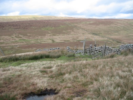
The route takes you up the right hand side of a wall; there is no path but it is easy going. You pass a hut on the left hand side of the wall. Shortly a wall comes in from the right; you have to climb over it. Continue to climb the fell side tracking the wall.
Plover Hill is on the right and in the far distance is the distinctive form of Pen-y-ghent. A further wall comes in from the left and the wall you're tracking turns right and then left and continues to climb. As you reach top of the ascent you hit a wall coming from the right. You have two choices. Turn right along the edge of the fell plateau and shortly a fence comes in form the left. Cross the wall and follow the fence heading SE to the summit trig point. The alternative is to cross the wall and head east of south across a peaty moor. Head towards what you think is the high point . On your right you will see the fence. The fence leads to the trig point and the top. We chose the later option.
The trig point is eroded from the original line by around 4ft. You can see Fountains Fell and the way ahead to the South West.
The route follows the fence back to the plateau edge where it joins the edge wall.
Cross the fence and follow the edge wall on its right hand side heading south west. The wall drops down then climbs up towards the plateau of Fountains Fell.
As you track along the edge you get views of Pen-y-ghent.
A wall comes in from the left. Cross to the opposite side of the wall via a gate and track up the left hand side of the wall on a track made by quad bike. You can see 2 large cairns on the horizon, which marks the Pennine Way .
A wall joins from the right and the wall turns left and climbs up to the Pennine Way . It crosses the wall at a NT sign. We had a rest and as we sat the weather came in and the snow started. We were going to follow the wall round to the north/south summits of Fountains Fell, but because of the weather we decided that we'd follow the path down to Dale Head.
Cross the wall and a good track (the Pennine Way )descends North West , then turns left and descends further just south of west along the line of a fault to a wall coming down the side of the Fell.
As you descend you are confronted by the wonderful outline of Pen-y-ghent your next target. Turn right and follow the wall down (it's on your left). As we dropped we came out of the wind and the temperature rose dramatically.
You cross a wall and then drop down to Silverdale Road . Above you looms Pen-y-ghent a magnificent sight.
Turn left and walk down the road for a 1km. Half way down you pass the farm at Rainscar. We were greeted by a couple of barking sheep dogs that tracked us down the length of the farm boundary. They never left the boundary of the farm even though they could have jumped over the wall onto the road.
Just before the road starts to drop take a track that goes off right ( FP Pennine Way) that leads to the farm at Dale Head.
As we neared the farm you could hear the shrill baying of young dogs in outbuildings. At the end of the building were a beautiful pair of adult foxes. Dead. A pitiful sight; but one that is no doubt pragmatic. The track goes down the rhs of the farm, through a gate, round the back of the farm and then the start of the ascent of Pen-y-ghent begins.
In 0.5km a path joins from the left, turn right and head for the southern escarpment of Pen-y-ghent which is now dead ahead and 1km away. The path climbs steadily and in 0.5km you reach the junction a wall junction. Cross a wall coming from the right and track up the rhs of the wall to the bottom of the major part of the ascent. As we walked up the wall a couple were descending. DS and I speculated whether we would meet them before they turned off. They beat us to the Bracken Bottom turn off. But a couple did come from Brackenbottom and we followed them up the escarpment. We caught them up half way to the top.
The first part of the climb to the top of the first lip of the escarpment is stoned and because it's limestone it's slippery in the wet. The rock then changes to gritstone which has a higher degree of friction. Near the top we stopped for lunch as we were out of the wind. The views are stupendous looking over toFountains Fell and down Silverdale. It was a good choice because as soon as we left and hit the top the wind was blowing and it was cold.
In 250m you reach the trig point and a lovely stone wind break. The views of the surrounding fells are worth the effort. 2 guys were eating their lunch and taking pictures on their phones. They looked overweight and as if it had taken them a major effort to get there. They were happy.
At the trig point cross the wall and turn right (FP 1.75 m Plover Hill). Here at the bottom of the wall were a pair of abused waterproof gloves. They looked as if they had been laid to rest. The path follows left hand side of the wall.
The wall heads north east to the end of the fell top then turns left and drops down heading due North an unusual occurrence. After 0.5km the wall turns and heads east then north east, ascending to the top of Plover Hill. As we closed in on the top a couple of runners overtook us. The second person was a lady who was clearly struggling in the conditions.
At the top of Plover Hill the path is blocked by a wall heading almost east/west. Cross the wall via a stile and take a good path going off straight ahead and heading east of north.
The path descends gently at first to a wall, before dropping sharply down an escarpment care is needed in the wet before the gradient lessens.
In 0.5km the path splits. Take the right hand path and shortly you hit a path running from Horton to Foxup at the wall you have been tracking down the side of Plover Hill.
Turn right cross the wall through a gate (FP) and track along the valley side heading east for Foxup.
The going is easy and in 1.5km the path drops down to the Foxup road at a wall. Below is the valley bottom and Foxup Beck.
As you track along Foxup Road , you can see Foxup in front and below you on the left, where the Beck joins the Skirfare. It always looks to me as if the track will never turn down towards Foxup as it looks as if the track takes you past the hamlet.
When you are almost due south of the hamlet and just before a wall, the track turns left and heads down the valley side. In 300m the track hits and crosses the wall before tracking over to a second wall. Cross the wall and turn left (FP) dropping down to Foxup. A 5 bar gate gives access to a lane that runs down the side of the beck. Turn right down the lane. On your left is the beck. Two small stone bridges give access across the beck to the farm and hamlets.
In 100m the lane crosses the Skirfare at Foxup Bridge . Just before the bridge turn right on a path (FP).
The path tracks down the western side of the river for 0.75km to Halton Gill Bridge . It's a pleasant walk but as always the weather was far from perfect.
Cross the road and continue to track the river with a wall on your right. After 300m the wall moves away from the river. The path follows the line of the wall until after 0.75km the wall turns right and the path continues straight, crossing a number of fields and past a line of barns on your right.
It's classic Dale's countryside with walls and barns. Eventually after crossing a wall a track goes off diagonally right to the farm at Nether Hesleden. Continue straight (FP) to another wall.
Turn right and in 20m left down a track for 20m to a gate in a fence. Turn right through the gate and take a path down to the corner of a field where a stile gives access to the farm track.
Turn right on farm track through a 5 bar gate then immediately left down a wall to a bridge that crosses Hesleden Beck. As we dropped down to the Beck we were greeted by a group of dogs, friendly but barking loudly. After crossing the bridge, immediately turn left and walk down the bottom of a field with the Beck of your left. There were,as always, two grey friendly ponies in the field. From here the path follows the line of the Beck through a further two fields before turning right away from the Beck
The path enters a walled lane and passes New Ing Barn. In 0.5km the path hits the track you climbed in the morning giving access to Darnbrook Fell. Turn left on the track, pass through a gate and New Bridge is on your left.
Continue ahead, keeping to the west side of the Skirfare the river is on your left down a lane. In 400m take a path off left (FP Litton).
The path crosses diagonally a couple of fields to a footbridge.
Cross the bridge over the Skirfare and take a path that tacks round the right hand side of a river side cottage, into a lane and up to the road through Litton.
Turn right down the road to the car.
Summary
A lovely walk with splendid views from the tops.
The route finding is quite straight forward and, with the exception of the ascent up Darnbrook Fell, there are paths all the way round.
The only people we saw were on Pen-y-ghent/Plover Hill. It was blowy and cold on the tops with flurries of drizzle snow.
There was little wildlife. The occasional rabbit, a few grouse and partridge and a wader that we almost trod on.
Home Start Point Dales Books Related Sites TextOnly Map&Summary
Home Start Point Dales Books Related Sites TextOnly Map&Summary