Embsay CrookriseCragBurnsall&ThorpeFellLowerBardonResHaltonHeightEmbsayCragEmbsay
17th March 2006 & 22nd January 2010
A Cross, Memorial and Reservoirs
Who went: NN,JK,TS (2006) DS (2010)
Weather: Cold & freezing at Embsay with snow and ice above 330m. But the cloud was around 2000ft so could see things all day. From Embsay to Rolling Gates there was snow coverage and ice. But after that the temperature rose and the going was easier.
.(2010) There had been snow from before Xmas but after a week of warmer weather most of the snow had gone in the valleys but on the tops there was drifting snow up to 2/3ft deep along the walls and in the tracks. The cloud was down at 300m and it drizzled for most of the day. It was miserable
Parking: The car park is in the centre of the village off the main road. It is well marked and free. There is another car aprk at Embsay reservoir. Neither has a toilet. But next to the car park in the village is a public house and there are tea rooms at the mill on the road back to Skipton.
The Walk
From the back of the car park take the left hand path to Pasture Road (FP). As you enter the field there is a notice asking you to keep your dog on a lead to prevent further injury to sheep. It makes you wonder.
The path goes up to a wall and turns left over the wall essentially following along the bottom of a number of fields at the back of the school - kids were in the play ground - crossing walls using stiles well marked with yellow spots.
At Pasture Road there is a mill pond system. You drop down to the road at the top pond. Turn right and head up the road towards Embsay Reservoir.
At first junction, just under the dam wall take the left hand fork and follow the FP sign post marked to Embsay Fell and Embsay Kirk fell.
Continue to climb until you reach the reservoir. Here is another parking area - owned by the Water Board.
At the reservoir there is a second FP to Embsay Kirk Fell - 13/4 mile and Embsay Fell 1 mile.
At top end of the reservoir the road turns left. There is a sign saying no public access along the road. In the fence on right there is a stile - access to open country side. At this point there is a sign saying no dogs - the Chatsworth Estate! Cross the stile and turn left following the fence up the side of the road until you are just above the buildings at Tattersall Green.
Here turn right and follow the right hand side of a wall.
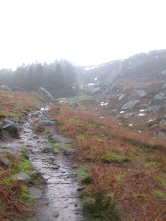
The path climbs up the side of Crookside Wood and up onto Crookside Crag. It's a good climb and a reasonable path. (2010) as we got to the wall we essentially entered the grey world of cloud and could see very little until we dropped down off Burnsall and Thorpe Fell.
The rocky eminence to the east is 'Deerstones' a reminder of the days when herds of deer roamed these parts
It's a good climb to Crookside Crag. By now it was snowy and frozen. There were lots of prints of from a 'renard' and sheep and pheasant clearly marked in the snow. It looked as if no one had been up on the hills for some time - sensible as it was cold.
(2010) It soon became clear we were in for a hard days walk. The snow had drifted up to the wall the follows. It covered the path and was quite deep in places. It meant we had to walk on the heather! Even then I ended up with a wet foot as I put it in a very wet green slimy pool of weed.
You soon reach Crookside Crags. The edge is a few yards over the wall and afford many hours training for the rock climber. The famous Norwegian and Lakeland climber Cecil Slingsby of Carelton has left his name on one climb - Slingsby Chimney'
The summit and the trig point of Crookrise is 1361 ft and on the opposite side of the wall to the path. You continue along the right hand side of the wall and a little further along views opens out further country to the North and on a clear day the flat topped summit of the noblest of all northern hills can be seen peeping over the left shoulder of Kirkby Fells - Ingleborough
Eventually the ground starts to drop down into Waterfall Gill Beck. Here the path turns right leaving the wall and dropping under Hellifield Crag before descending just above a waterfall to the Beck.
(2010). As we started to drop to the Beck we could hear it. It was in full flow and made for a spectacular sight with water gushing over the waterfall. You didn't want to end up in the water and we had trouble finding a place to cross.
Cross the Beck and climb up to a wall at the top of the beck above you. Here you pick up a path along the right hand side of the wall. Soon you meet and cross the path that runs from Rylstone to Halton Heights. If you turn left here you drop down and pass the site of Norton Tower on the left.
Looking down you can see Norton Tower, supposedly. This was erected in 1887 on the occasion of Queen Victoria's 50th year of reign on top of the plinth erected after the battle of Waterloo
Rylstone Cross will be visible ahead.
Keep alongside the wall, the path leads past Rylstone Crags where many fine rock problems including 2/3 40ft climbs.
Climb up the side of the wall towards the Cross. Again you have to cross the wall to get to the Cross. This is in an airy position overlooking the valley running from Flashby to Cracoe.(2010) we could just see the valley below as for an instance the cloud thinned. In the far distance the War Memorial can clearly be seen. It was very cold on top with an easterly wind chilling to the marrow. The 'Buffalo' was good but when I took my gloves off the old hands soon got cold. Leading up to the Cross I had to put my hood up to keep warm.
The next feature is Cracoe War Memorial which stands out prominently on Watt Crag.
Keep on right hand side of the wall until you get to the war memorial. It provides an excellent panorama of the countryside including Ingleborough Whernside & Buckden Pike. At the memorial looking east you can see Upper Barden Reservoir. (2010) we could just make out the memorial!
From the war memorial the path begins to descend. Keep once again to the wall and pass Peter's Crag, Bartle Crag and finally Rolling Gate Crags is reached.
After Peter's Crag you pick up the line of a shooting track. (2010)We were looking forward to this but as I'd found in previous weeks it was full of snow , so again we were walking on heather. Eventually the wall bends left and falls down the hillside. On here I fell on ice near Potter Gap. Stepped on ice and over I went. Don't turn down hill but keep on the shooting track which above Rolling Gate Crags turns right and heads just south of east. (2010) My feet were now quite cold. After 3hrs in the snow my boots were full of cold water from snow getting under my gaiters and melting. It was not pleasant
The distinct rounded hills below on the left are limestone and are called reef knolls believed to have formed from fossilised sea creatures that once inhabited the warm seas lapping at the edge of higher land. A little like the Great Barrier Reef - a bit warmer here.
The track twists and turns somewhat but generally heads eastwards. Paths go off to the left - north - and towards Thorpe.
Soon you come across a shooting hut - not marked on the map. There is a house and out shed. In the out shed were benches. TS found a water proof in a bag. From the hut you could see the Tarn at the top of Gill Beck and a chimney - marked on the map. (2010) We had lunch out of the rain and wind in the hut. It was quite pleasant
Eventually the track splits. The right hand path drops to the Tarn and on down to Nelly Park Wood.
(2010) we turned right and walked down past the chimney and tarn meeting the track from Numberstones End just above Simm Bottom.
Take the left hand path heading towards Numberstones End. - couldn't find the path to Burnsall - covered by snow - or the cairn marked on the map.
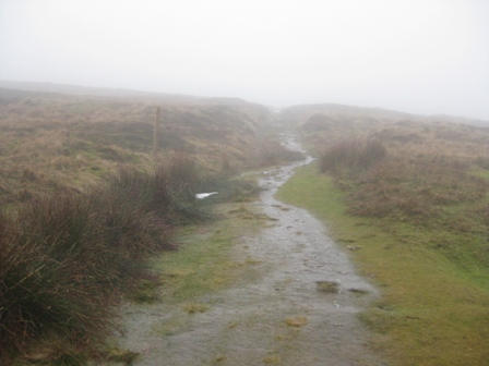
We continued on the track. It descends across Simm Bottom. Out of the wind it got warmer. The ice under foot went and as we got to Nelly Park Wood the snow largely descended. The track was easy and muddy and crosses Gill Beck before climbing up to a 5 bar gate in a wall with Nelly Park Wood to your left. Go through the gate and turn right up a track which follows the left hand side of a wall. Through the gate on the left we lunched in the wall corner. 8 miles on the GPS and arrived around 12.35. (2010) The snow had largely disappeared from the track by the time we got to the wood. We wouldn't find much until we got to Halton Heights. In addition becasue it was warmer my I could feel my feet and although they were wet they were warm. And I was happier.
Stopped for 25 mins and had lunch in a nice sheltered spot amongst tall grass. It was sheltered from the wind. We noticed that over the wall they had chopped trees down and some large branches were stood up against the walls as if they were drying them out. Very strange. Took soup which was nice and hot!
The track heads west of south climbing Long Band Flat towards a small coppice - not on the map. It's a pleasant climb to the coppice, through a gate and out the other side.(2010) The coppice has been chopped down and the trees burnt. You can still see the stumps.Out of the coppice the high point of the path is reached which now starts to descend to the Low Barden Resevoir.
As you descend views of the reservoir opens up and beyond Halton Heights is on the horizon. Into the top of the reservoir Barden Beck flows and if you look back up the Beck the dam wall of the Upper Barden Reservoir can be seen. It had a covering of snow and looked like a bank of snow!.
How to cross the reservoir? As you drop down to the top of the reservoir you come to a track which goes up to Upper Barden Reservoir From here a path drops down diagonally left to an embankment at the top end of the reservoir. A good crossing point. The map indicates a path across it. Take the path through the bracken leading to the embankment. BUT when you get there there is a sign saying no public access to the embankment! I presume this means the southern bank of the reservoir. A path takes you across the embankment, in the middle of which is a fence and stile.
At the far side of the embankment a metal footbridge gives you access to the northern side of the reservoir. At the far side the path climbs to a track and a finger post saying left to Halton Height. So we turned left on the track and walked down the reservoir. By now the distant fells looked grey and it was clearly drizzly snow.
Walk along the track for 0.8km until you reach a T junction with a track which runs from the reservoir dam wall to the Embsay/Barden Bridge road. At the junction another sign says you can't cross the embankment but again a path is marked!
Turn right along track (FP) and climb up to the road. It's a good climb of over 0.5km. (2010) We say the first people all day - rangers in a warm Land Rover.
At the road turn right (FP). Don't take the track immediately on right.
Walk up the road across the bridge and after twisting round a bend turn right up a track (FP Rylstone). The sign from the Chatsworth Estate says no dogs. Ignore it. Don't follow the track too far. Climb up a short distance then branch off on the left hand side heading due west on a weak track heading towards an outcrop.
Behind which is another outcrop and large cairn which hides the trig point at High Crag on Halton Height.
From High Crag the days route opens out. A grand view spoilt by low cloud as Cracoe Fell and the memorials were in cloud. What you can now see is Embsay Crag to the west.
Contour along the moor heading west towards the trees which is boundaried by a wall.
(2010) we met with drifted snow again but here the path is several feet from the wall so we could walk on it - even though it was very wet. When you reach the wall turn right and follow it west towards Embsay Crag. The path is a little boggy in places - yes a foot went in and water went over the top - , but its clear which way to go.
Just before you reach Heugh Gill you have a choice of routes. You can turn left and drop down to Eastby and on to Embsay saving 1.5miles or you can go up Embsay Crag. (2010) we turned left and cut the day short - see below. For Embsay Crag cross Heugh Gill and carry on by the wall until you reach a path that is broad and well trodden that leads up Embsay Crag. There are posts with blue markings to follow. A lot of people have clearly been up the Crag. It's a nice climb to the top where there are good views of Lower Wharfedale and Embsay. The path down to the reservoir is clear. The top of the descent is more like a Lakeland but it opens into a peat track and yes the second fall of the day - a wet bum. Half way down on peat. Wet and soggy. When I got into TS's car it transferred to his seat! They are leather!
At the reservoir follow the track to the right to where the access point to the moors is reached where we started in the morning. Turn left and walk down the road past the reservoir and mill pond. At the bottom mill pond and on the left hand side of the road is a Manor House dated 1665. Idyllic. A little further on the right hand side is a closed mill factory boarded up but over a door it still said employees, drivers and tradesmen only!. Sad
Keep taking the left hand road past the school with lots of cars parked outside and only room for one to travel up. At the road junction there is a pub - closed when we got there. Turn left and just past the pub is the car park. A welcome sight.
(2010) We turned left over a stile before the path dropped and crossed Heugh Gill. The path heads diagonally right along the left hand side of a wall to a stile by a gate.
Over the wall the path/track heads down the left hand side of Heugh Gill.
The Gill is below you and after crossing a wall you then cross a track before dropping down through an area that looked as if there had been mining.
At the bottom of this the path drops into a wooded glade, which was rather muddy.
At the bottom of the glade you crossed a stile (FP) and walk down a short track to the main road at Eastby.
Turn right and in 30m turn left down an access (FP) track which takes you down the left hand side of a row of cottages before turning right and walking down the back of the cottages.
After crossing a stile the path goes down the leftt hand side of an allotment area.
From here you cross a couple of stiles and a field and enter the left hand side of a farm by hay covered in plastic sheeting and tyres.
At the yard turn right and walk through the farm yard ( the way is well marked with yellow way markers) turning left before the cow shed and walking out of the farm down its access road. the Beck is on your right.
After 400m the track turns right over the beck and walk along the bottom of a field to the left of Greenfield House. Here you meet a road (FP). Turn right and walk up into Embsay.
The road soon bends left. Carry on straight past the Methodist Church, past an old black letter box on your left and soon the car park is on your right.
Summary
A good walk, It was cold on top. We passed no one all day. It should be a good walk on a good day with opportunities to lengthen the walk - to Thorpe/ Burnsall or change direction going to Cracoe and Rylstone. You can shorten the route coming down via Eastby rather than going onto Embsay Crag.
Route finding is straight forward and there are good paths and tracks all the way round.
There are lots of grouse and pheasant - perhaps that's why they said no dogs! And the foot prints of a fox.
At the end of the day we took the car to Ikley and had a nice tea at Betty's. Unfortunately I forgot about my wet bum and left stains on TS's front passenger seat and in Betty's!
(2010) A long hard day. The going meant we struggled to walk at 2mph and afterwards my heart monitor said I had averaged 83% of max. The hardest walk I'd done for over 2 years. It highlights again the impact of going and weather and the need to have ways of shortening the route in need be. It was a miserable day and I didn't realise how wet I got until I took my boots of and squeezed water out of my socks. I had cramp on the way back and had to get DS to stop so I could stretch it off. As in 2006 there were a lot of grouse and pheasant who were all quite tame.
Home Start Point Dales Books Related Sites TextOnly Map&Summary
Home Start Point Dales Books Related Sites TextOnly Map&Summary
Pictures from 2010