CrowdenTorsideWainBleaklowHeadDoctorsgateOldGlossopPAdfieldCrowden
9th January 2009
Lost glasses and lost opportunity
Who went: PNO, PH
Weather: Low cloud until mid-afternoon then clear. Cold with 100mm of snow on the tops. Still, with little wind even on the tops. The small reservoirs were frozen and but the 3 main ones only had ice in the side arms.
Parking: Park at the car park at Crowden. It's free. Today the car park was closed. The weather all week had been at or below freezing and there had been snow. The drive down to the car park was like glass so it had widely been closed. There were only the 3 cars there. Fortunately the toilet was still open!
The Walk
The objective had been to attack Bleaklow via Ogden Clough and to descend via Higher Shelf Stones, James Thorn and Self Benches and to return via Cock Hill. When I left home for Crowden the skies were clear until Woodhead Tunnel. Westward from the tunnel was a bank of cloud. So we took a route that we had been on before as I want to do the intended route when the visibility is good. I wonder how long that will be?
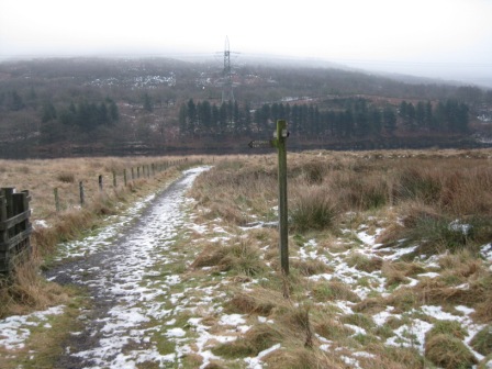
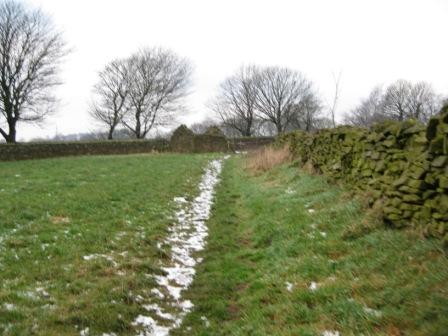
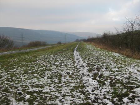
There were remnants of snow on the road and all the paths. From the car park entrance turn right heading for Manchester and cross the Woodhead Road. 30m down turn right down a concessionary path that leads to Torside Reservoir bank. In 30m there is a FP, carry on forward for 200m until you reach the reservoir bank. Here the path bends right and crosses a bridge over Crowden Great Brook. The path now follows the reservoir bank for 0.5km to a footbridge.
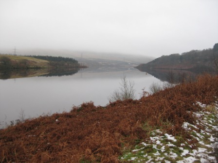
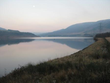
The water in the reservoir was glass smooth, reflecting Bleaklow as a mirror image. A pity the cloud was so low as it would have made a magnificent picture.
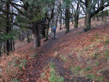
After a short distance the path picks up a stone wall and subsequently follows the reservoir drain on your right. The path then crosses the drain via a footbridge and climbs up some steps into Tinsel School Wood.
The path runs through the wood just below the Woodhead Road crossing a wall and a footbridge. In 0.5km it hits the Pennine Way path descending from the right. Carry on forward through a gate through the woods for a further 0.5km crossing 3 walls until you come to the end of the wood.
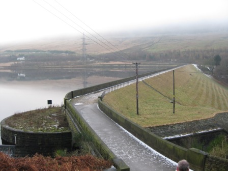
Descend to a gate and cross the reservoir drain descending on steps to a lane that leads to the reservoir wall. For the first time in a year the reservoir overflow was in operation; last year repairs had been done in the reservoir and it had been empty. What a change.
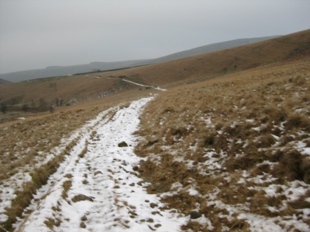
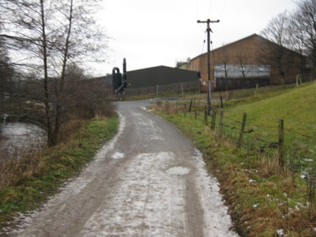
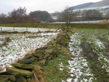
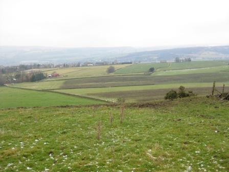
Cross the reservoir wall. The views up the reservoir are magnificent in the right light. At the far side, turn left and ascend up the dam access road to the B6105. Here turn right (FP) and shortly cross the road (FP) and turn left up a track (FP) leading to Reap Farm. This must be the area with the greatest density of finger posts in the country. It's a good track and marks the beginning of the ascent up to Bleaklow Head.
After 400m and just before Reaps turn right up a track (FP). The ascent now begins in earnest.
After 200m at post turn off the path and continue to ascend up to a gate in a fence. The path turns right and then left and tracks up the edge of the Clough.
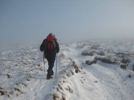
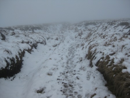
By now we were in cloud and the path was snow covered although it was easy to follow because of previous walkers. However, in places it was very slippery because of ice. The path climbs up to Reaps Bent and from here the gradient eases as the path tracks Clough Edge. The walk up the side of the Clough is quite pleasant but today the cloud was down and the moors were covered in snow, which got thicker the higher we climbed. P said that the day before he had walked onto Kinder and from the trig point looked over onto Bleaklow. He said that there was little snow on the south side. Somehow it didn't seem probable from what we were finding. But it was interesting walking. As you climb, the Clough comes closer to the path.
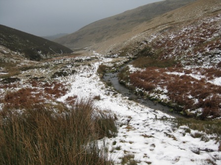
1.6km from Reaps Bent the distinct feature of Wildboar Clough hits the Torside Clough from the left; take a marker from a stile 10mins walk from Wildboar Clough. You have a choice. The main Pennine Way goes up Wildboar Clough but we decided to ascend up Wildboar Clough to Wain Stones. So at the junction with Wildboar Clough we carried on straight with Torside Clough on our left. As you climb the path follows the line of the stream and after 0.5km the main Clough and the path bends left (heading east) and climbs for a further 0.75km to the distinctive form of Wain Stones. Keep to the main water course.
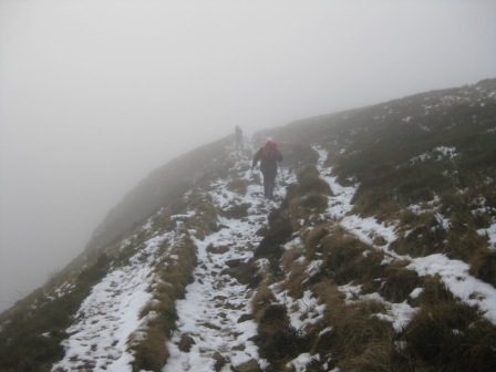
Within 0.5km of the top there was 100mm plus of snow and previous tracks had been covered, but the line of the stream and path is not difficult to follow. As we approached the top the sun tried to come out; it brightened then succumbed to the grey mist again. One tip remember to keep an eye on the lie of the land as you are heading for the summit.
Up here there was little wildlife. We could make out the footmarks of sheep and pheasants and perhaps the odd hare and fox. There were lots of grouse and you could walk within 3m of them without their usual noisy flight. It was as if they were frozen by the bleakness and so cold that they couldn't or wouldn't move. This phenomenon was to follow us right over the top until we dropped out of the cloud descending down |Doctors Gate.
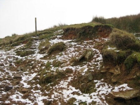
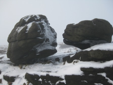
Wain Stones was covered in a layer of ice, but someone had been there recently. Care is needed in poor visibility to find Bleaklow Head as the land from Wain Stones to the summit cairn and post is flat. You can easily get disorientated up here. It's flat and in mist the paths are indistinct because of the sandy nature of the surface. With snow and with few people visiting care is needed. Head north of east and keep an eye on the lie of the land; there are also some stone marker posts for the Pennine Way.
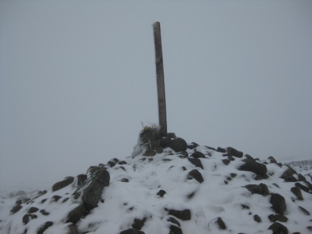
After a 200m you should see the cairn and its post. Although it is quite distinctive with a layer of snow on the cairn stones it was unfamiliar and it was only the post that gave it away. I left a book on the top. It was picked up by DS on Great Knoutberry Hill one of his favourite summits - and left at mine!
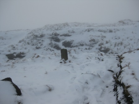
From the summit cairn head south and pick up a stone PW marker post. PNO had convinced us that there was little snow on the southern side of Bleaklow; or at least there was the day before. It was deeper than on the top; the lesson is be wary of truths spoken by locals. Again care is needed especially when visibility is poor because if you miss the path you're in peat hags and groughs so it's essential that you hit the stone marker. Once you find the stone the path follows a grough. There are another couple of markers to keep you heading south down the right groughs until you hit the watery reaches on Hern Clough after around 0.5km . The path follows the Clough until the stream turns sharp left (east) and descends down to Grains in the water. There is a PW stone marker here. Cross the stream and follow the top of the Clough for 100m before turning right onto a partly flagged path that leads to Devils Dyke. The worst of the route finding is now over.
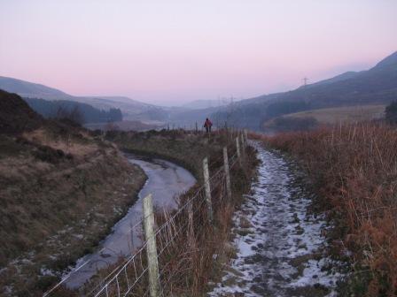
Follow the dyke to the junction with the Doctors gate path, which is marked by a post. Although its only 0.5km from the Snake road we couldn't see or hear traffic on it which is a pity as the views on this part of the route are good.
At the post turn right (east) down Doctors gate and the descent into Old Glossop. After 300m you hit the edge of Crooked Cliff, you cross a fence and start to descend rapidly down into the valley. The going was slower than normal because it was slippery underfoot.
As we dropped we came out of the cloud and it got brighter and we met a lone walker climbing up into the cloud. 1km after the fence you cross the stream in the valley bottom via a wooden footbridge and the path follows the northern side of the brook. Funnily enough the path was worst just down from the footbridge as you had to traverse across a grass bank above the river. Because of the snow it was slippery and I'm surprised that one of us didn't slip into the river.
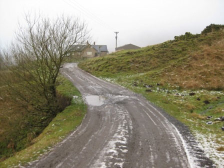
The river now becomes Shelf Brook and from the grass bank a good path climbs and turns into a track which leads to a wall behind which is a building. A farmer was in a big 4x4 as we approached but we scared him off! There's a FP here to convince you that you're on the correct path! Strange because there's only one footpath here.
The track follows the wall (on your right) and descends down to the junction with another track (FP with 2 fingers pointing in different directions to Glossop). Turn right, cross a bridge and turn left down the track. The track crosses a couple of walls and after 0.75km it becomes fenced and ahead you can see the factory chimney that marks Old Glossop. In a further 1km you hit the bus turn round in front of the factory. Near the bottom a farmer was repairing a barbed wire fence. He asked what it was like on top. When we told him there was a covering of snow and low cloud he said it had been like that for a couple of days. Who was right PNO or the farmer; see what I mean about locals!
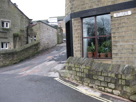
Past the bus turn round turn right up a road that runs up the side of the factory and then past some houses. In 150m the road (Hope Street) takes a sharp left and drops down into Old Glossop. At the bottom of the hill turn right into Wellgate and climb up to a road junction just in front of the church.
Here turn right up a genal by the side of a pub (pub is on your left) to a road. Turn left, then right and then left down Castle Hill. As the houses stop the road turns into a track then a path.
The path climbs up a couple of fields along the right hand side of a wall to the corner of a wood. Half way up the fields the farmer has put an electric fence. Peter hadn't realised what it was so graciously we stopped him getting the shock of his life. As you get to the edge of the wood the path cross a fence and follows the left hand of the edge of the wood to another fence. Turn left away from the wood and follow track round the field with the fence on your left.
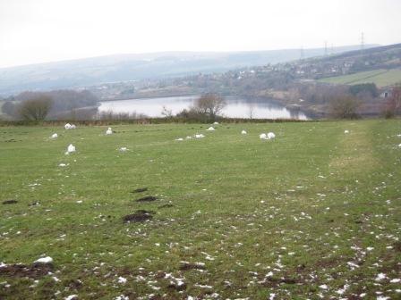
You quickly hit a wall, where you turn right and follow the wall down heading towards Swineshaw reservoir. This was almost completely frozen over except for a corner where a group of geese were floating and calling out. Just before you hit the reservoir wall turn left and cross the wall you have been tracking via a stile. The path now climbs up to the Woodhead road B6105 tracking the left hand side of a wall.
At the road turn right and cross the road. At the far side of a house with a grass roofed outbuilding turn left (FP) and walk up the right hand side of the house using its drive. The house is being renovated and the owner has woodworking equipment in the back buildings and oak on the back garden. He was planeing a large oak section as we passed. As the drive bends round the back of the building keep ahead and go out of the house garden at its top right hand corner into a field.
Track a wall up to a building (ahead over a wall is Glossop Cemetery) and turn right into a field. Track the right hand wall.
After 100m the wall drops down to a stream (where the map says there's a footbridge but I can't see one) and in the corner of the field is a stile. Cross the stile and turn left tracking down the right hand side of a wall. This drops down to a cluster of buildings at Little Padfield Farm.
Turn left down the farm lane and in 20m turn right and just to the right hand side of a 5 bar gate turn left through a stile and track round the side of the farm buildings. Down the right hand side edge of the building turn right through a gate in front of a stable. There was a fearsome looking horned ram in the field but as we went through the gate it moved as if it had arthritis. Walk in front of the stables to the top right hand side of the field and turn right and cross the fence via a stile.
The path now tracks straight up a field to the end of a short lane with houses, which marks the northern end of Padfield. Access to the lane by the last house is gained via a stile . Walk 20m down the lane to a road (Padfield Main Road) and turn left. Walk down the road and take the second lane on your right (FP but look carefully for it as it's up against the wall of a house) just before a road comes in from the left.
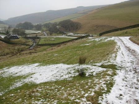
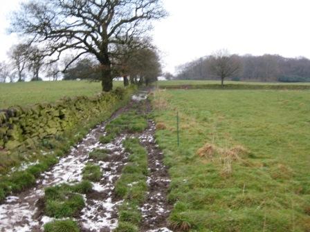
By now the cloud had lifted and it was a clear late afternoon. There was no sun but the views showed what we had missed during the day; it must have been stunning on Bleaklow in the sultry but clear conditions. The track drops down and away from the village. After 0.5km turn left over a stile and drop down through a field to the old Sheffield to Manchester railway track; the Longdendale trail.
The field you dropped through had the remains of 20/30 snowmen that the village children must have built. It looked quite surreal.
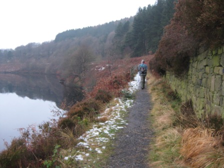
Turn right (FP) on the trail and follow it for 2.75km until you hit the B6105 just above the Torside reservoir dam wall. As usual there was a mixture of people on the trail. It is very popular no matter what the weather. When you hit the road you are now at the Pennine Way and the way back is the reverse of the route taken in the morning. Turn left (FP) down the track that leads to and crosses the dam wall. At the far side turn right off the road (FP) and climb up a series of steps crossing the reservoir drain to a wood. Enter the wood and turn left on a path that follows the line of the Wood head Road which is above you on your left. You cross two walls before hitting a gate. Shortly after the gate turn right and continue through the wood for 0.5km until the path drops down to a footbridge that crosses the reservoir drain. As an alternative need not turn right but continue up to the Woodhead road and follow the Pennine Way back to Crowden. However, in the evening light walking by water is always to be preferred.
It was magnificent in the dusky light and stillness. How can anyone not like our country in these conditions? PH was doing his normal trick of shooting off trying to get to the car first. His only problem is that he wasn't sure of the route! Te He.
The path follows the bank of the reservoir, initially with the drain on your left, then a wall before crossing Crowden Brook on a concrete bridge and turning left and away from the reservoir to the Woodhead Road. Turn right, cross the road and turn left into the car park access road.
Postscript
When I got back home I realised that I hadn't got my glasses; yet I remember taking them out of my jacket in the boot so on Saturday back I went to Crowden. What a surprise. The weather to the top of Woodhead was over cast but from the top westward it was clear. Bleaklow looked magnificent and was covered with gleaming crystal white snow. A magnificent sight. At Crowden the car park was still closed and there must have been around 50 cars parked on the side road. What a contrast form the day before. But I couldn't find my specs. Coming back we went via the Snake and Bamford. From the top of the Surprise view to Ringinglow the road was in low cloud and the trees and grass covered in hoar frost. What a difference 10 miles makes.
Summary
An interesting walk because of the weather and conditions. The route finding needs care in poor visibility towards Wain Stones, onto Bleaklow Head and down the first section of the Pennine away to the south of Bleaklow Head. Other than that the paths are clear and in the valleys well sign posted.
Home Start Point Peak District Books Related Sites Text Only Map&Summary
Home Start Point Peak District Books Related Sites Text Only Map&Summary