Reeth Fremington Edge Booze Whaw Great Punchard Great Pinseat Turf Moor Reeth
9th April 2010
Mines, Gills and Moors
Who went: DS
Weather:The perfect day. Sunny periods. Warm enough to wear a base layer when walking but a top needed when stopped because there was a cool breeze. Had to wear sun block. Forgot sun hat but wore summer trousers; could have worn shorts.
Parking: On the green. They ask for a £1 donation for the upkeep of the green. A sensible way forward. There are toilets, cafes and a pub around the green. There is a market on Fridays so you can't park on the hard standing.
The Walk
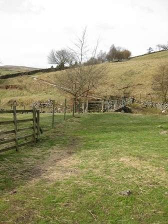
From the green walk back down the road towards Richmond. Cross Arkle Beck and just after the car dealers show standing area turn left (FP) up a path/track.
Walk up a track and in 100m as the track bends right carry on straight following the rhs of a wall. Ahead of you is Fremington Edge.
You cross a wall and then carry on straight aiming to the right of a barn nb there is a painted notice on a stone gate post to the left of the building saying keep out'.
Cross a further wall via a stile then follow the wall on the right round nb it feels as if you should keep low but there is another further notice telling you to keep out'. Eventually you turn right at a FP through a stile in the wall you have been tracking .The path now climbs up a field before crossing a wall into a field with a barn.
Climb up to the left of the barn to the top wall of the field.
Cross the wall (FP) and head straight climbing up the line of an old track with a wall on your left. This is where the real climbing starts and it's a good climb to the top of the edge. The track eventually begins to bend right but keep straight ahead following the line of the wall on your left. This climbs up to a wall which is crossed using a ladder stile. The steepest part of the climb waits. From the wall keep straight ahead and climb up the fell side on a faint path.
Always keep going straight for the top heading for a FP which you can see (if it's not cloudy) at the top of the climb. I must say I struggled up the two steep sections and as we neared the top a lady and her son were climbing up the track from White House. He was singing and chattering to his mum as if it was a gentle stroll. It was anything but that for me. Eventually you'll hit the track where you turn left and climb up to the FP.
There is an excellent view of Reeth below in the valley from the top.
At the FP the track divides. The FP tells you to take the right hand track for Fremington Edge and climb up to a wall. Here you turn left and track the right hand side of the wall for 2km until you turn left over the wall on a path from Hurst to Langthwaite. But you miss the views of Arkengarthdale if you take this route. So take the left hand track which follows Fremington Edge for 2.5km with fine views up and across the dale. But the views were enhanced by the first sightings of the year of curlews, skylarks and lapwings. I've missed these bedfellows of the high moors.
Taking the edge track you cross 5 walls via stiles before reaching a dominant cairn at the end of the ridge. Ahead on the far side of Slei Gil is the noticeable feature of North Rake.
From the turn right and drop down to a well cairned track 100m away that comes from Hurst and heads for Langthwaite. Turn left on the path and descend.
The path soon bends round on itself and drops into an area where there used to be mines and is now a lot on mining spoil; it's quite well marked with way marker posts and it would need to be in snow.
In the area of spoil the path bends right and drops down a track to a gate in a wall on the left (FP). Turn left through the gate and drop down on a track which initially follows the left hand side of a wall before dropping down to the left hand side on Storthwaite Hall.
Turn right and walk on a tack in front of the Hall. The owner was painting a window frame in the front garden and a couple of walkers came towards us; I don't know why, but they reminded me of the Nuttalls'.
Having immediately passed through a 5 bar gate at the end of the hall turn left and drop down to and cross a footbridge over Slei Gill before joining the access road to the hall on the far side. Turn left and walk up the cement tracked access road to a path that comes from the left (FP).
Turn right up the path.
In 50m turn left (FP) off the path and climb diagonally right to a gap in a wall. In the next field continue straight to a further gap in a wall (FP).
In front of you is Booze. Head straight ahead to a five bar gate (FP) by a large black barn. Go through the gate and in 50m you reach the access track to the hamlet.
Turn left on the track which climbs before dropping down into Langthwaite, 1km away.
As we dropped into the village we were met by a girl walking her dog or rather the dog taking the girl for a walk. This was followed by a by a father and daughter then the mother and the second daughter. The latter two were walking uphill backwards. You won't get far walking like that' I jibed. We were told that it's easier to walk up hill like this' they replied. You do meet some funny people. Walk into the village and turn right up the first lane just before you hit the village square. In 20m you enter a field via a 5 bar gate and follow the rhs of a wall up a long field. 50m up the wall is a weather vane and a small gate. Through the gate is a coit's pitch.
Continue walking up the field. Above you is a wood. We could hear a woodpecker taking it out on one of the trees. A woodpecker' came a shout from the path that tracks the edge of the wood. The girl with the dog and the parents and daughter were on the upper path.
The path crosses a couple of walls before you see Scar House ahead. You cross a further wall before reaching the outbuildings to the house. Go through a five bar gate in front of a house and continue ahead to the Scar House drive.
Turn left and walk down and cross the bridge over the Arkle. Scar house never seems to be used. The downstairs rooms always have their shutters closed. I suppose it was a shooting house for the estate. Whatever the use now the walled gardens that you pass on either side of the drive before you cross the river are well manicured and looked after. We had a rest on the bridge wall and counted our blessings that the weather was so good.
After crossing the Arkle the track divides. Take the right hand track and walk past a couple of cottages. The track again divides. If you carry on straight you climb to the CB Inn; an old coaching inn. However, we take the main track that bends right through a five bar gate.
In 400m you hit Stang Lane (FP) to the left of a bridge over the Arkle. Cross the road and go straight through a gate (FP) onto a path that drops to a footbridge over the Arkle.
On the far side of the footbridge turn left. The next 2km is a lovely walk up the northern bank of the Arkle. This section vies with Upper Wharfedale and Littondale for one of my favourite river walks. I have to say it comes third but it still remains a lovely walk.
The first part to Yealand House follows the river. It always amazes me that owners at Yealand leave organic eggs out for sale in a wooden structure. They couldn't do that in Carlton.
From the House the path enters a wood that soon will be full of blue bells before dropping down into the flat valley bottom. You cross a number of wall before ahead on the right you can see a distinctive form of a rake to the right of Whaw Scar.
Below the Scar is the hamlet of Whaw; the last outpost before Tan Hill. I always think of Whaw as Watendlath in the dales; a remote cluster of buildings. Unlike Watendlath Whaw does not have a cafe or a tarn.
You enter the hamlet through a 5 bar gate (FP) with the buildings on your right. Continue ahead before turning left along the road into the hamlet.
Cross the Arkle on a lovely stone bridge and climb up to the Tan Hill road.
Turn left on the valley road and walk towards Reeth for 150m before turning right up a track (FP). This is the start of a pleasant 3km climb to the top of Great Punchard Gill and the last remnants of buildings at Punchard Coal Levels. I always like this climb; it's relentless but the gradients are not steep so you can keep a good pace.
After 500m and below the tips of Darby Lead Level the track bends right and heads north west towards Great Punchard Gill. In a further 1km you cross Little Punchard Gill.
The track then divides.Take the right hand track which soon crosses Great Punchard Gill at Routh Level.
There is now 1.5km of climbing; the steepest gradients on the trek to the top Punchard Coal Level. Just before you reach the top the track heads off right and climbs away from the Gill towards West Gill. We had lunch at the level. Now that we had stopped it was cold enough for us to put another layer of clothes on to keep warm. Out of the breeze it was pleasant.
Cross the gill and take a good path that contours round the top of the peat moor - Punchard Moor.
Initially the path heads south east but slowly it begins to bend right round the Moor.
You cross two clear groughs before you hit a distinctive third grough after 20mins of walking where the path turns right and heads south to Little Punchard Head 0.8km away.
You know that you're approaching Little Punchard Head as you can see Great Pinseat on you left and below it a tarn. There was smoke coming from around the tarn. In fact there were fires on the moors as far as you could see. In all there we saw over 10 moor fires during the day. It was a good day for burning as the heather was dry, the peat wet , there was a gentle breeze and there was plenty of surface water.
Cross the stream and rake at Little Punchard Head and on the far side climb up to a cairn. Ignore the path off to the right and heading south towards Old Gang Mines.
Instead at the cairn head straight ahead east along a distinctive fault that drops down and passes to the left of the tarn and to the left of the summit of Great Pinseat. As we approached the tarn the fire that was burning to its right hand side went out and two six balloon wheeled vehicles came over to a stream by the track. As we approached it was clear that the vehicles had pumps and water tanks and that they were being used either to control the fires or practice their drivers fire-fighting skills. They were great vehicles ideal for wet moors. The front and back wheels could be turned and at least four of the wheels were drive. They could go over boggy land that we wouldn't walk across.
From the tarn the path climbs, before bending right. Shortly the path bends left, you can follow the track round but I would advice leaving the track and heading straight (south west) to the trig point of Great Pinseat. In clear weather you can see the trig point which is in front of a wall shortly after leaving the track. It's 0.4km of walking over wet heathery moorland to the top. But the views when you get there are worth the effort. North you can see Cross Fell and the Dun Fells and South there is Great Shunner Fell, Lovely Seat, Ingleborough and the southern fells. As we looked back the fire raisers we had passed at the tarn started their raising again.
From the trig point head due north aiming for a mound which is a spoil heap and is on the track that you left. When you reach the track turn right.
It's easy walking on a good track through the remnants of lead mining. After 0.3km the track divides at a cairn. Take the right hand which keeps on the tops through spoil heaps of Martin Vein. We could hear children's voices and eventually saw a couple and their kids to our left wandering around the mining area at Surrender Ground.
Keep to the track which twists through the mining debris. Here we found two Land Rovers and trailers clearly they used these to get high on the moors before using their land rangers.
From the edge of the mined area it's 1.5km of gentle descent down a good track to the road at Turf Moor. As you make the descent ahead of you is Calver Hill.
At the road turn right and walk down the road for 0.5km to a gate on the left above a steep switch back in the road.
Turn left through a five bar gate onto Fore Gill Gate. Ahead was a young girl on a massive horse being followed by two ladies. 50m along the track turn right off the main track and take a path that contours round the southern side of Cringley and Calver Hill.
It's a good path with a couple of way marker post. Consequently you can make progress.
1.4km after leaving the road you reach the stone walled fields at Cleabsy. At the far side is a way maker post which seems to say go straight ahead on a good track that stretches out across the moor ahead. In fact the footpath turns right and heads down to another stone walled area. Don't go right but carry on straight on what must be a shooting track. It was the only time I have begun to get annoyed with the Dog as I knew we were not on the footpath and he insisted we carry on the track. His was the right decision as the path we were on kept us on the moors and away from habitation.
After 1.3km we reached a track at its junction with a path that went north south across Calver Hill (FP).
Turn left along the track heading east towards Reeth. After 0.5km and just before a second gap in the wall on your right turn right through a five bar gate and drop down a twisty access track leading to a house. There is no way marker at the gate (I wonder why) but you can't miss the gate.
Just in front of the house turn left off the track and head for a stile at the bottom left hand corner of the field. This is the start of a track down through fields where you cross 12 stiles and go through 1 gate ( 2 gates if you include the one at the top of the access drive) until you reach the school at the outskirts of Reeth. It's a well walked path and is quite easy to follow.
Initially it follows the lhs of a wall before crossing the bottom side of a series of fields. We caught an old couple up as we walked this section. Some of the stiles are not the easiest to get across.
All is quite straight forward until you get into the penultimate field. Here go straight and ahead you can see a wall and above it a fenced section. The stile is at the top of the fenced section.
From here head straight for an electricity pole and shortly beyond this you hit a track (FP) that runs up the side of the school. Turn right and walk down the track to the road. Note there is no FP at the road!
Turn left on the road and walk into the village and the car.
Summary
A lovely walk with fine views from Fremington Edge and Great Pinseat. All day you are walking through mining areas which if permission was sought now to open them up would be fiercely opposed. But in the middle of the 19 th century thousands of people mined these fells. The route finding is straight forward and all day you are on good paths or tracks.
Today was the first day this year that I saw curlews, skylarks and lapwings. Spring is clearly in full swing
There were a number of people out especially round the valleys but we didn't have to greet that many as we could see them at a distance. Thankfully we didn't see any cyclists. The dog gave it 9/10.
Home Start Point Dales Books Related Sites TextOnly Map&Summary
Home Start Point Dales Books Related Sites TextOnly Map&Summary